Trail Changes and Notices

Map 39 – Peninsula – Cape Chin area, annual closure
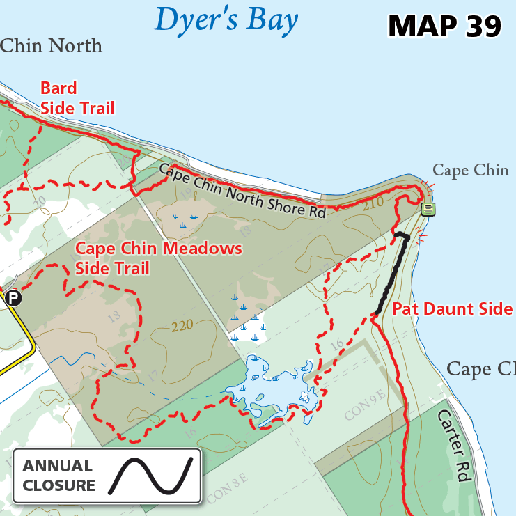
Map 39 – Peninsula – Cape Chin area, annual closure Date Effective: May 1, annually | Map 29, Edition 31 At the request of the landowner, this segment of the Bruce Trail will be closed annually for one day on…
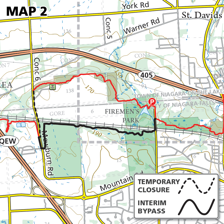
Map 2 – Niagara – Concession 6 Road Closure – LIFTED

Map 2 – Niagara – Concession 6 Road Closure – LIFTED Date Effective: Apr. 29, 2024 | Map 2, Edition 31 This closure is no longer in effect as of June 19, 2024. Concession 6 Road (from the Niagara-on-the-Lake/Niagara Falls…

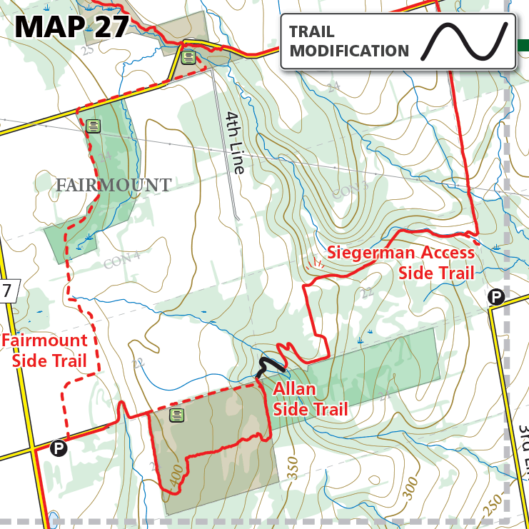
Map 27 – Beaver Valley – Fairmount area reroute

Map 27 – Beaver Valley – Fairmount area reroute Date Effective: Apr. 23, 2024 | Map 27, Edition 31 The Bruce Trail has been removed from a road allowance and routed on to private land near the BTC’s Allan property.…

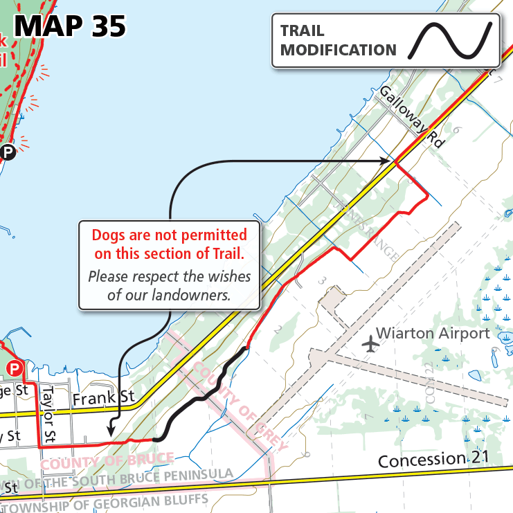
Map 35 – Sydenham – Reroute near Wiarton Airport

Map 35 – Sydenham – Reroute near Wiarton Airport Date Effective: Apr. 23, 2024 | Map 35, Edition 31 An improved route has been established for the Main Trail near the Wiarton Airport. A portion of Trail was removed from…

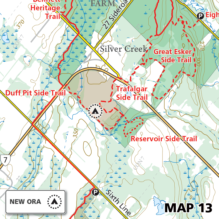
Map 13 – Toronto – Silver Creek Overnight Rest Area (ORA)

Map 13 – Toronto – Silver Creek Overnight Rest Area (ORA) Date Effective: Apr. 10, 2024 | Map 13, Edition 31 A new Overnight Rest Area (ORA) has been designated on the Bruce Trail Conservancy’s Silver Creek protected natural area.…

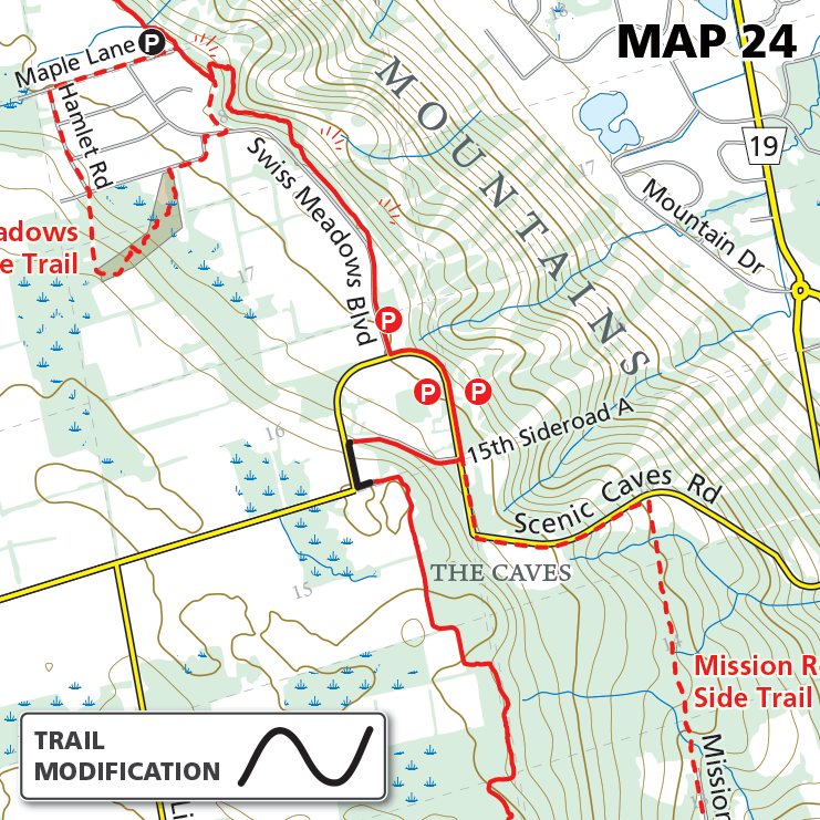
Map 24 – Blue Mountains – Scenic Caves Road reroute

Map 24 – Blue Mountains – Scenic Caves Road reroute Date Effective: Mar. 25, 2024 | Map 24, Edition 31 A portion of the Bruce Trail has been rerouted onto Scenic Caves Road, for a 180 m stretch, to avoid…

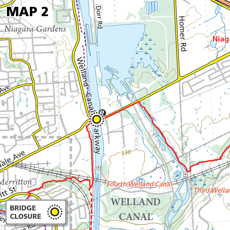
Map 2 – Niagara – Glendale Bridge Closure

Map 2 – Niagara – Glendale Bridge Closure Date Effective: Mar. 4-13, 2024 | Map 2, Edition 31 The Glendale Avenue bridge over the Welland Canal is closed Mar. 4-13, 2024 for bridge/road maintenance. The bridge is closed to vehicle…

Please Consider Making a Donation

$
One-Time Gift